Critical Content: Blinded By the Light
- David Moore
- Jan 23
- 3 min read
Updated: Jan 24
A Critique of ArcNews' Pittsburgh Lights Article

Welcome to a new wrinkle in the Dave Moore Media blog: Critical Content. This is the first of an occasional series of critiques about technical/informative writing that caught my eye. It's a throwback to the days when my old college newspaper advisor – Phil Angelo – used to page through the paper we had just produced, and discuss it with its writers.
This inaugural Critical Content post focuses on the ArcNews Winter 2025 edition article "Pittsburgh Lights an Innovative Path to Streetlight Design." We get ArcNews delivered to our house because we've used Esri for mapping, and I came across the content while browsing through its pages.
DISCLAIMER: I am by no means a digital mapping savant or a coder. My expertise is making highly technical or jargon-filled content understandable to a more general audience. Also, I'm not accounting for any edits Esri might have made to Mesler's original content for ArcNews.
This a great topic and technical change for Esri, which has developed some pretty cool mapping tech to solve – or to at least visualize – global and local problems. In this case, guest author Nick Mesler – director at Evari GIS Consulting – describes how a team at Evari developed a digital tool to look at how effectively street lights were illuminating Pittsburgh's hilly, winding roads. What's more, they were able to compare daytime traffic crashes to twilight and nighttime crashes, whether bike lanes were illuminated, and even light use in environmentally sensitive areas. One key challenge – according to Mesler – was trying to provide safe lighting on hilly topographies, without frying people's retinas (my words, not his).
Overall, it's a pretty good article about a very interesting topic. Further, it should be acknowledged that ArcNews is a far more technical publication than something that would be read by the general public, such as a newspaper. But there was a BIG miss, along with a few fumbles.
My Critical Content critiques:
It Buries the Lede
My eyes bulged out at the end of the article, when I read that Evari's tech will likely save the city of Pittsburgh MILLIONS of dollars. How? By reducing city plans of installing between 3,000 and 15,000 lights, to about 1,100 new lights. As Mesler rightly points out, the strategic installation and positioning of just relatively few additional lights will save lives and prevent injuries.
Here's how I would have rewritten the lede:
What if your city could potentially save millions of tax dollars while making your streets safer, by improving its lighting?
Mesler needs to remember that as cool as Evari GIS' tech is, engineers still need to convince city managers/taxpayers to spend money on it.
It Strays Into the Weeds
Mesler's writing is incredibly detailed. Arguably, it's too detailed, straying too far into engineer-speak. For example, when Mesler conveys that better lighting can reduce crashes by 42%, it takes him 56 words to get the point.
Its Graphics/Illustrations Are Obscure
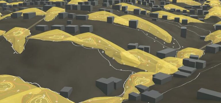
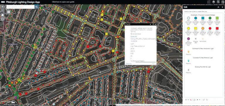
The graphics used to illustrate how street lighting works in Pittsburgh raises more questions than answers. Is this image:

supposed to show how the old lighting system worked, or the new one?
Are those loops in the image below between roads dark spots that should be lit, or are they quarter-acre lots?

Over all, a great article, and mostly well-explained.
Comentarios